Chicago, Illinois – A wave of severe thunderstorms is set to hit Chicago and the I-290 corridor on Wednesday, July 30th, bringing dangerous weather conditions, including strong winds, heavy rain, and a risk of flash flooding.
A weather alert has been issued for the region, with damaging winds up to 60 mph, the threat of flooding, and hazardous beach conditions expected to disrupt daily routines for residents, commuters, and beachgoers alike.
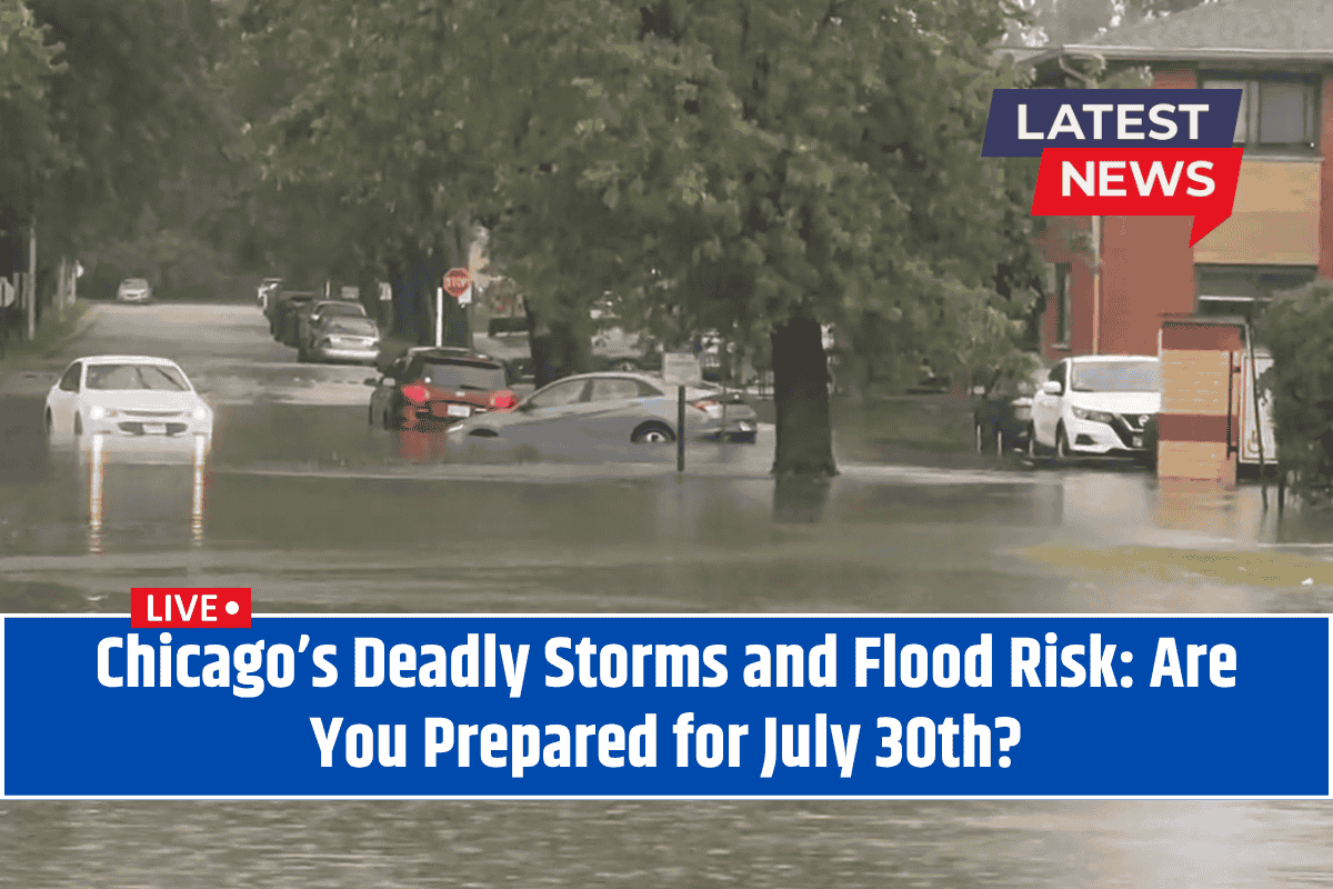
Thunderstorms, High Winds, and Flash Flooding Threats
According to the National Weather Service in Romeoville, a strong cluster of thunderstorms will move through Chicago and surrounding areas after 7 a.m. Wednesday.
The storms will bring torrential downpours, which could lead to rapid flooding on key roads, including I-290, I-55, and surface streets across Cook and DuPage counties. The heavy rain could cause significant disruptions, and there’s a high risk for localized flooding, especially in low-lying areas and at intersections.
In addition to the rain, high winds of up to 60 mph and frequent lightning will pose hazards for anyone outdoors, especially during the morning and midday hours. The National Weather Service advises residents to avoid flooded streets and never attempt to drive through high water.
If you encounter flooding, it’s crucial to turn around and find an alternate route. Keep your phone charged to stay informed in case of power outages.
Dangerous Beach Conditions
Along the Lake Michigan shoreline, dangerous swimming conditions are expected due to high waves and rip currents from Wednesday through Thursday. A high swim risk is in effect, and beach closures may occur due to these hazardous conditions.
Lifeguards are urging swimmers to stay out of the water until the situation improves, as the currents could pose a significant danger.
What to Expect After the Storms
The storms are expected to linger into Thursday morning, but by late morning, conditions should start to improve with periods of clearing.
However, the break in the weather will be brief, as sunnier and milder conditions are expected to return by Friday, August 1st. Highs will reach a pleasant 73°F, making Friday a great day for outdoor plans. Saturday will remain dry and warm with highs in the mid-70s, offering ideal weather for summer activities.
Looking ahead, another round of storms could arrive by Sunday, August 3rd, so residents should stay updated on local weather reports.
Five-Day Detailed Forecast: Chicago, IL
Wednesday, July 30: Strong thunderstorms likely after 7 a.m., high 77°F. Damaging winds, torrential rain, and local flooding risk. High swim risk on Lake Michigan.
Thursday, July 31: Showers and storms possible early, then clearing. High 73°F. Dangerous beach conditions continue into the morning.
Friday, August 1: Sunny, pleasant, high near 73°F. Great day for outdoor plans.
Saturday, August 2: Mostly sunny, high 75°F. Dry and warm for summer activities.
Sunday, August 3: Partly sunny, high 77°F. Chance of showers and thunderstorms late.
Monday, August 4: Partly sunny, high 79°F. Scattered storms possible.
The Chicago area faces a serious weather threat on Wednesday, July 30th, with severe thunderstorms, damaging winds, and the potential for flooding. If you’re planning to be outdoors or on the road, make sure to stay safe by avoiding flooded streets and dangerous beach conditions.
With sunnier, milder weather expected to return by the weekend, there will be a brief reprieve before the next round of storms possibly hits on Sunday. Stay weather-aware and follow local updates for further advisories.


