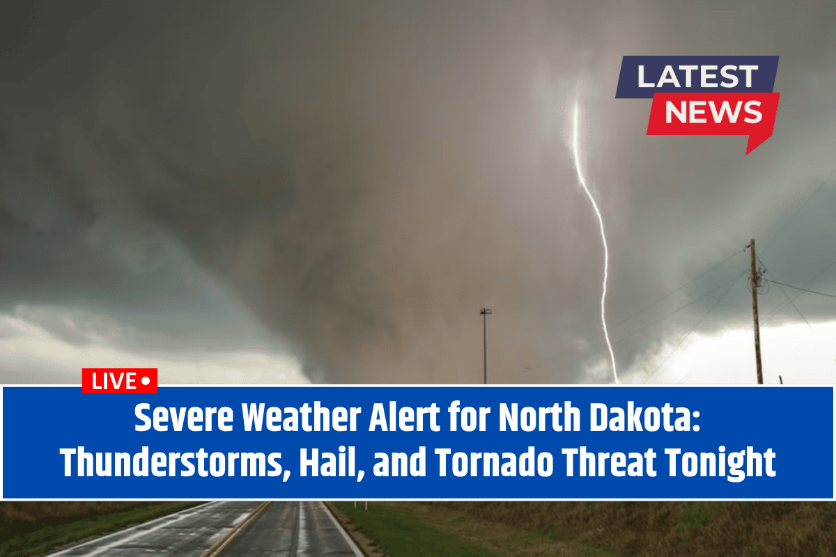
A severe weather alert is in effect for North Dakota tonight, with powerful thunderstorms expected to bring the threat of tornadoes, large hail (up to 2 inches in diameter), and damaging winds.
This alert is mainly for the eastern part of the state, including cities like Fargo, Grand Forks, Wahpeton, and Devils Lake. The storms are expected to start this evening and could last into the overnight hours.
What to Expect from the Severe Weather
According to the National Weather Service in Grand Forks, the Red River Valley and much of eastern North Dakota are at an elevated risk for severe storms. The key hazards include:
Tornadoes: Although not guaranteed, tornadoes are possible, particularly with isolated storms.
Hail: Hailstones may reach up to 2 inches in diameter, which can cause significant damage to cars, crops, and roofs.
Damaging Winds: Winds could gust up to 70 mph, strong enough to uproot trees, cause power outages, and damage structures.
High-Risk Areas and Roads
The cities at highest risk are Fargo, Grand Forks, Wahpeton, and Devils Lake, along with major routes like I-29 and U.S. Highway 2. Residents in these areas should be prepared for rapidly changing weather conditions.
Heavy rain and debris from storms could make driving dangerous, and power outages are likely due to the strong winds.
Safety Tips During Severe Weather
Residents and drivers in the affected areas are urged to:
Monitor weather updates: Keep track of the latest warnings and advisories on your mobile device or through a weather app.
Prepare for power outages: Charge your phones and other devices ahead of time in case of a power failure.
Stay indoors: If you are under a warning, stay inside and away from windows and doors. Seek shelter in a basement or interior room if a tornado warning is issued.
Be cautious when driving: Avoid driving during heavy rain or storms, as visibility will be poor, and road conditions may be hazardous.
How Long Will the Severe Weather Last?
The most intense part of the storm is expected to happen from late Tuesday night into the early hours of Wednesday. However, the weather threat may continue through the night, with additional watches and warnings possible as the storms develop. It’s essential to stay alert and be prepared for any changes in the forecast.
Severe thunderstorms are making their way across North Dakota tonight, bringing with them the threat of tornadoes, hail, and damaging winds. Residents in affected areas should stay alert, monitor the weather, and take necessary precautions to stay safe.
Be ready for possible power outages and dangerous driving conditions, and stay indoors during warnings. This storm is part of the region’s typical peak for summer weather, but it’s important to take it seriously.


